Topography
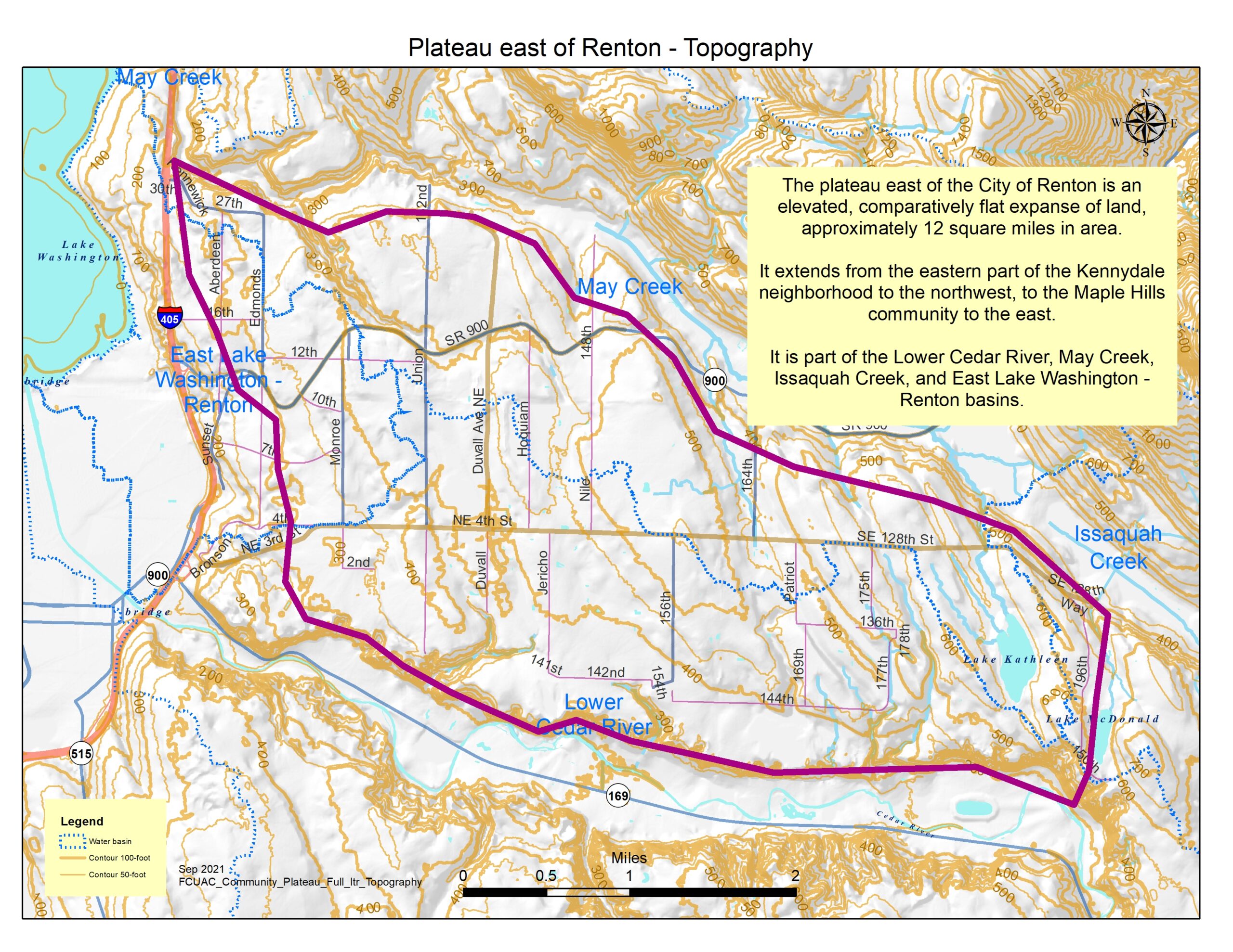
The plateau east of the city of Renton is an elevated, comparatively flat land expanse that extends from the eastern part of Kennydale to the northwest to Maple Hills to the east. The plateau includes approximately 12-square miles, and is part of the Lower Cedar River, May Creek, Issaquah Creek, and Eastern Lake Washington – Renton basins.
Jurisdictions and potential annexation areas
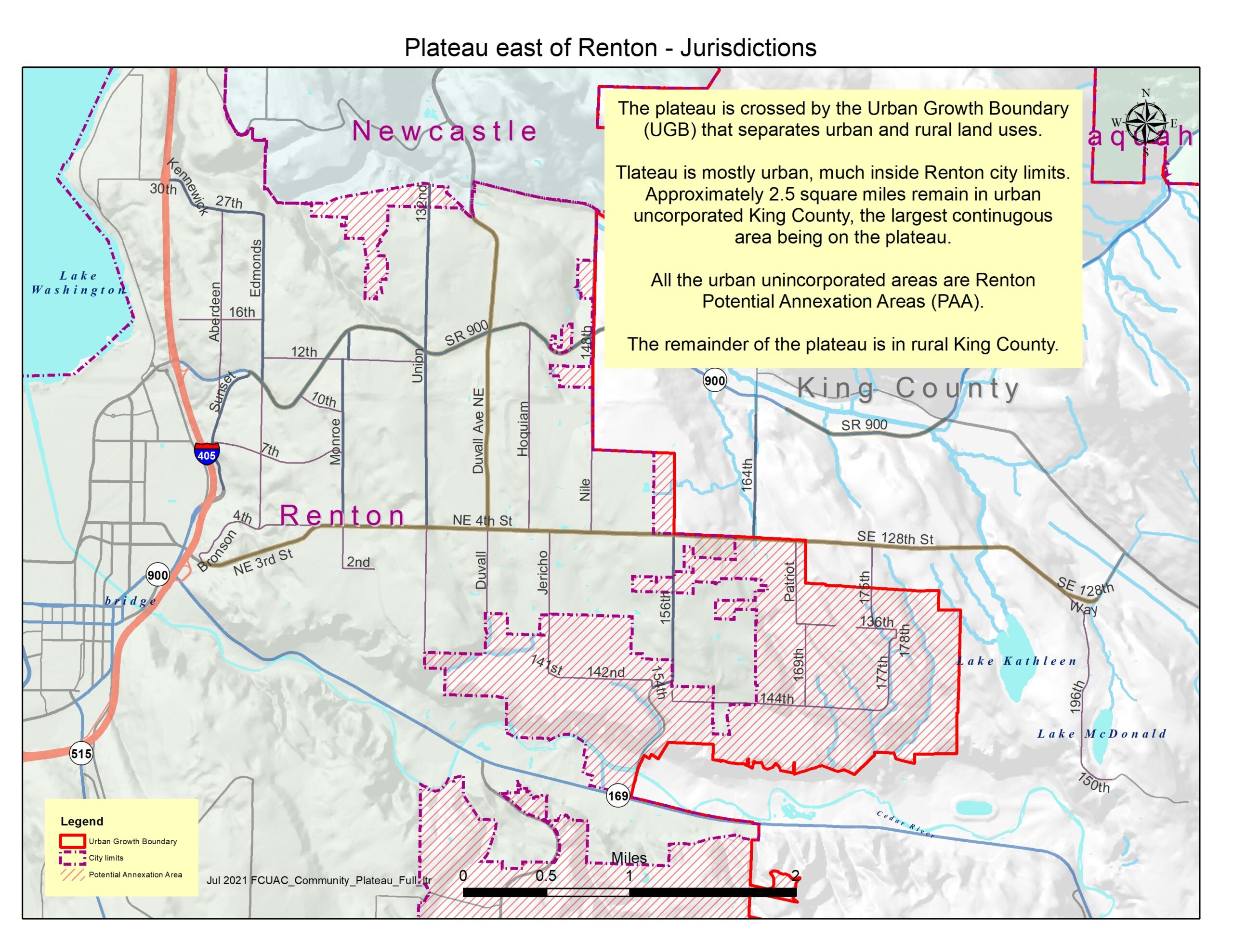
The majority of the plateau is in the city of Renton or one of its Potential Annexation Areas. The remainder is in rural King County.
Renton land use and pre-zoning
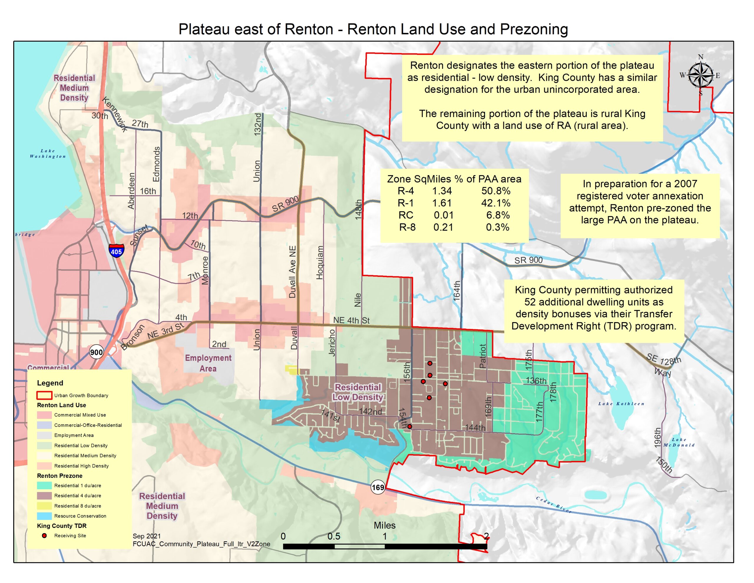
Renton land use shows a pattern of higher density toward the urban core, and lower densities the further away from that core.
Renton pre-zoned a large portion of the Potential Annexation Area on the plateau in 2006 as a lower density residential area. The lower density also provides some protective “buffering” the rural area on the eastern part of the plateau.
Annexations

Since 1992, there have been 51 annexations on the plateau that have included roughly half of the original 5-square miles of urban unincorporated area on the plateau. All the annexations have been development-driven.
Emergency preparedness resources

DRAFT emergency preparedness map for the community on the plateau east of Renton
Map table being worked on
Map title Theme Scope Image links
Plateau jurisdictions Jurisdiction Plateau .jpg
Plateau topography Topography Plateau .jpg
Plateau annexations Annexations Plateau .jpg
Plateau zoning Land Use & Zoning Plateau .jpg
The Plateau map gallery
Topography Jurisdictions & potential annexation areas Zoning and annexations Plateau preparedness resources