

Atlas Program Images
Four Creeks Unincorporated Area Council
The Atlas Areas
The Atlas Areas page contains extracts from the Atlas Warehouse that are "area" oriented.
The purpose is to define the areas of interest which currently include King County, the UAC, its Districts, its Subareas, and project areas.
colLeft
King County
King County area is used for maps to orient the UACs and to provide an area definition for attribute comparisons.
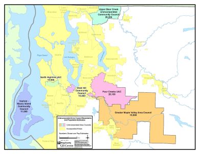
FCUAC_KC_UACs
King County Unincorporated Area Councils. The boundaries will need to be updated when FCUAC completes its precinct update. Because the FCUAC area is defined by a list of voting precincts, annual changes done by King County Elections can change to FCUAC borders
UAC Area
This is the Four Creeks Unincorporated Area.

FCUAC_Test_GDB_basemap-white_deleted_hatch
Basemap sample
Districts
These images are samples of a district map (using district 7).
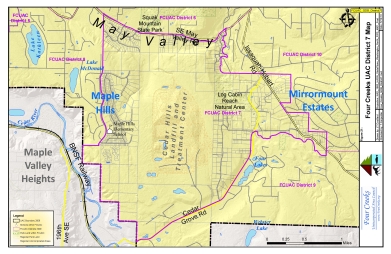
FCUAC_GDB_District7
District 7 sample
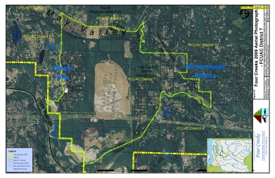
FCUAC_GDB_District7-aerial
District 7 sample
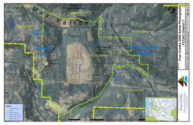
FCUAC_GDB_District7-aerial-hillshade
District 7 sample
Subareas
This is the May Valley subarea.
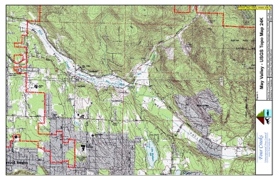
FCUAC_May_Valley_USGS_24K_3
USGS map of May Valley
Project areas
There are three initial project areas: Tributary 291, May Valley, and a safety map with the overlap of the Sheriff's Storefront districts and the UAC.

FCUAC_Test_GDB_WIP_T291
This map is used to identify the Tributary 291 project area. The actual project area map is pending.
colRight